| Towns and villages |
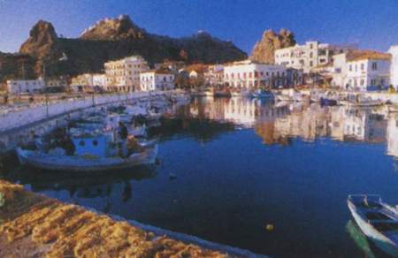
MyrinaMyrina, the island's capital and port, a population of around 5,000 inhabitants.
has built on the same spot where the old city of Myrina was located. It extends
from two seashores which are joined by a castle-crowned rocky headland with
a splendid sea view. It is a beautiful town builtin
a traditional style with many picturesque, narrow streets, houses and a market
place. The impressive, fortified castle which hovers over the town can be reached
either from the market, the harbour, or the Romeikos waterfront. The stairs
which begin at the church will lead you straight to its entrance. The rocks
on which it was built make it impregnable even today. Deer and roebuck roam
freely in the nearby caves. Worth seeing in the town are the Karatzadios Library,
the Cathedral of Agia Triada with its two splendid belfries, and the Archaeological
Museum with its huge collection of finds. The harbour is always animated and
most of the town's services are located there. The commercial street begins
from there and connects the two shores. The town is filled with fragrances emanating
from the white plane trees, eucalyptus, jujube trees and tall almond trees which
dot the area. Myrina is divided into two suburbs, "Tsas" and "Androni".
The name "Tsas" is a Russian word meaning" station" which
has In the centre of the island is Atsiki, a village named in ancient times. When the island was under Athenian rule, the people from Athens that immigrated and settled in the area named it "Attici"in memory of the region they had left, they also planted olive and fig trees from Attica. Later with the "tsitakismo" (Tsitakismos is an idiom of the language according to which the "t" is pronounced as a "ts") which was dominant in the island at the that time the name changed to "Atsiki".Its a large village 22 kms from Myrina, near the airport, with 800 residents. It cultivates wheat, raisins and dairy products. In addition to the women's bakery co-operatives, the village operates a distillery. There are two versions as to the name kontopouli. The first derives from two words linked together "konta-poli" (near the city) because it's built near the ancient city of Hefestia. The second is that in the area there was a large agricultural community which belonged to a land owner called Kontopoulos.Kontopouli is a main village with stone houses built on a large plain where wheat used to be cultivated. It is located near two scenic lakes, Aliki or Asprolimni,where salt used to be gathered,and Hortarolimni, which is a marine park. Also worth visiting in the area are the archaeological site on the gulf of Bournia, the remnants of Hephestia, Limnos' oldest town from the Ancient Greek period, the temple of Kaviria and finally,the cave of Philoctetes on the other side of the cliff.
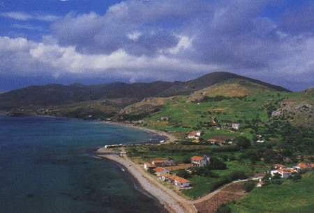
Nea Koutali is one of the prettiest villages in Lemnos. Built on the
bay of Moudros, it spreads from the Agfa Triada pine forest to the graphic,
stone-built port where fishig boats and caiques are moored its houses a well-kept
and their gardens are covered with rose bushes and vines. A clearly immigrant
village, Nea Koutali was built in order to receive the flood of refugees from
Marmara's Koutali, home of the legendary Panagis Koutalianos. These immigrants
were
|
| NEXT PAGE |
 |
|---|
 |
 |
 |